Learn More about Artsakh (Nagorno-Karabakh Republic): Askeran

Askeran region (one of the 8 regions of NKR) occupies the central part of NKR. During the Karabakh war the area was of strategic importance for the security of the NKR’s capital Stepanakert.
Territory and Population
Askeran region in the north and north-west borders with Martakert region, in the west - Kashatagh region. In south it borders Martuni and Hadrut regions until they reach the border, and in the south-east borders Martuni region. The state border with Azerbaijan passes through Askeran’s north-eastern part.
The district occupies an area of 1,222 square kilometers, with a population of 17,400 people.
The region has a mixed terrain: mountains in the south-west, plains in the northeast. The rivers Karkar, Badara, Kolatak flow through this region. In the past, as indicated by historical sources, part of Askeran region (right bank of the river Karkar) was part of the province of Varanda and the other part (left bank) of the province of Khachen.
According 2013 data, the Askeran region is home to 18,251 people.
Economy
The population of Askeran region of NKR is mainly engaged in agriculture and industries related to it. The most developed agricultural sectors are cultivation of grain and vegetable crops, horticulture and livestock. Winemaking, canning, timber industry, processing of tobacco, production of crushed stone and sand are also rather developed in the region.
Administrative division
There are forty-five populated settlements in Askeran region, including the regional center of Askeran, located fourteen kilometers far from Stepanakert. The town of Askeran arose on the site of an old military fort after 1920, and therefore got its name, which literally means "barracks." Since 1967, Askeran is considered to be urban-type settlement.
In the early 18th century a fort was established in the current place of the city, which after the accession of Eastern Armenia to Russia served as a stronghold of Russian troops for a long time.
The Askeran fortress, built in the Middle Ages, has been perfectly preserved till today. In the 18th century it underwent a major renovation and acquired its present form. This outpost of Karabakh played a major role in protecting the region from the Tatar thugs during the Armenian-Tatar clashes of 1905-06 and from Turkish invaders in 1918-20. Protective structures are stretching more than 1.5 km. on both sides of the river Karkar.
Sightseeings
In Askeran region of NKR numerous historical and architectural monuments have survived, among them of particular interest are Askeran fortress, the monuments of the village Avetaranots, the former residence of the princes of Varanda Melik-Shakhnazaryans, Bovurhanavank, Monastery of Surb Gevorg or Ptkes-Burke, the church Pirumashen in Sarushen village, the house-museum of the famous figure of the Armenian national liberation movement of the late 19th and early 20th centuries, Nikol Duman, in the village of Tsahkashat, some healing springs near the village of Aygestan, etc.
Besides, there is a village in Askeran region called Astkhashen ("village of the stars") as it rains stones from a rock like stars.
Be sure to visit the Askeran District of Karabakh, take a star for a memory, take a photo on the background of Askeran fortress and climb through the hole in Ulubabe: Karabakh-style longevity will definitely be guaranteed to you!
Other materials on this subject
- Gandzasar: World’s Architectural Masterpiece Today the monastery stand proudly high on the mountains as a symbol of unconquerable will and power of the Armenians, continuing to attack growing number of tourist every year.
- Not Liberated Territories or Something Else, but NKR Regions "Liberated territories" or the use of any other term makes a distinction between the NKR regions, separating the territory of the former Nagorno Karabakh Autonomous Region and surrounding territories....
- Learn More about Artsakh (Nagorno-Karabakh Republic): Shushi Near Shushi one can find one of the most beautiful places in Karabakh – the Gorge of Unotand. The rocky gorge with over three kilometers and with a depth of nearly 250 meters is covered by dense forests...
- Learn More about Artsakh (Nagorno-Karabakh Republic): Martuni Be sure to come to the NKR Martuni region, relax in the shade of an old plane tree, drink homemade wine of Martuni, and you will have a whole new view towards the world - the way it always happens in Karabakh,...
- Learn More about Artsakh (Nagorno-Karabakh Republic): Hadrut If Karabakh is a gold ring, in that case Hadrut is the diamond of that ring.

Read also
-
France, US urge 'immediate' end to Nagorno Karabakh blockade
-
ICRC facilitates transfer of seven patients from blockaded Artsakh to Armenia for treatment
-
Artsakh Foreign Minister sends a letter of condolence to Syrian Ambassador in Armenia
-
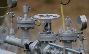
Azerbaijan once again disrupted the gas supply through the only pipeline from Armenia to Artsakh
-
Deputy PM presents humanitarian situation in blockaded Nagorno Karabakh to UK Ambassador
-

Gas supply to Artsakh partially restored
-

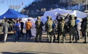
International Society for Human Rights: Azerbaijan must stop Lachin corridor blockage
-
Keeping international spotlight on Artsakh is among objectives, says State Minister Ruben Vardanyan
-
 17:08
17:08The regular session of the Anti-corruption Policy Council takes place in Jermuk
-
 15:05
15:05The Prime Minister sends congratulatory messages to the supreme leader of Iran and the President of Iran
-
 11:11
11:11Armenia sends earthquake aid to Turkey
-
 10:43
10:43Commemoration of the Pontiff St. Sahak Partev
-
 09:16
09:16Some roads are closed and difficult to pass in Armenia
-
 19:55
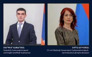
19:55Phone conversation of the Foreign Minister of Armenia with the U.S. Assistant Secretary of State for European and Eurasian Affairs
-
 18:30
18:30Prime Minister Pashinyan and President Khachaturyan meet
-
 18:20
18:20Ararat Mirzoyan with Co-Chairman of the OSCE Minsk Group of France Brice Roquefeuil
-
 17:01
17:01Humans could land on Mars within 10 years, Musk predicts
-
 16:45
16:45France, US urge 'immediate' end to Nagorno Karabakh blockade
-
 16:01
16:01Blockaded Nagorno Karabakh launches fundraiser to support quake-hit Syria
-
 15:59
15:59Earthquake death toll in Turkey rises to 18,342
-
 15:43
15:43Ararat Mirzoyan Held a Telephone Conversation with Sergey Lavrov
-
 15:06
15:06French president rules out fighter jet supplies to Ukraine in near future
-
 14:47
14:475 Day Weather Forecast in Armenia
-
 14:44
14:44President Vahagn Khachaturyan wrote a note in the book of condolences opened in the Embassy of Syria in Armenia
-
 14:20
14:20Azerbaijan’s provocations impede establishment of peace and stability – Armenian FM tells Russian Co-Chair of OSCE MG
-
 12:57
12:57France representation to OSCE: Paris calls on Azerbaijan to restore freedom of movement through Lachin corridor
-
 11:40
11:40Command of Kosovo forces highly appreciated preparation of Armenian peacekeepers
-
 10:16
10:16The United States withdrew from sanctions against Syria for six months the provision of assistance after the earthquake
day
week
month
Humidity: %
Wind: km/h